|
Map title
Bowles's New One-Sheet Chart of the Atlantic or Western Ocean, Laid down from the Latest Discoveries, and Regulated by Numerous Astronomical Observations.
Creator
Carrington Bowles
Map title
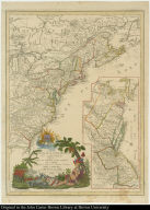
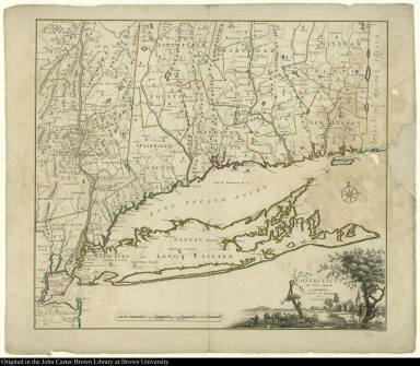
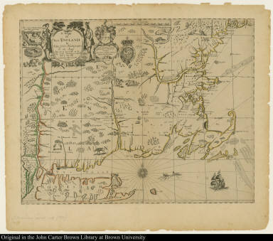
Connecticut and Parts adjacent.
Creator
[Bernard Romans, Hendrick Kloekhoff]
Map title
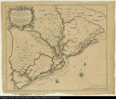
To the Right Honorable William Earl of Craven Palatine ... This New Map of the Cheif Rivers, Bayes, Creeks, Harbours, and Settlements in South Carolina ...
Map title
A map of the north west parts of the United States of America
Creator
John Fitch
Map title
A Map of the British Empire in America with the French and Spanish settlements adjacent thereto
Creator
[William Henry Toms, Henry Popple]
Map title
A map of Philadelphia, and parts adjacent. With a Perspective View of the State-House.
Creator
[Lawrence Hebert, George Heap, Nicholas Scull]
Map title
A Map of ye English Empire in ye Continent of America Viz. Virginia Maryland Carolina New York New Iarsey New England by R. Daniel Esqr.
Creator
[Roger l'Estrange, W. Binneman, Richard Daniel]
Map title
Algemeene Kaart van de Colonie of Provintie van Suriname, ...
Creator
Aleander de Lavaux
Map title
A Map of New England New Yorke New Iersey Mary-Land & Virginia
Creator
Gregory King
Map title
Atlantis Insula, à Nicolao Sanson Antiquitati Restituta
Creator
Guillaume Sanson
Map title
Novissima et Accuratissime Septentrionalis ac Meridionalis Americae Descriptio
Creator
Frederick de Wit
Map title
Nova totius terrarum orbis geographica ac hydrographica tabula.
Creator
[Steven Swart, Joannes Janssonius, Moses Pitt]
Map title
Nova totius terrarum orbis geographica ac hydrographica tabula
Creator
[Josua vanden Ende, Willem Janszoon Blaeu]
Map title
Nova orbis Tabula ... Mappemonde ou Description du Globe Terrestre & Aquatique
Creator
Charles Hubert Alexis Jaillot
Map title
A Map of Pensilvania, New-Jersey, New-York, And the Three Delaware Counties
Creator
[Lewis Evans, Lawrence Hebert]
Map title
A New Mapp of the north part of America from Hudson Straights commanly call'd the Norwest Passage Including Newfoundland New Scotland New England Virginia Maryland & Carolena
Map title
A Topographical Chart of the Bay of Narragansett in the Province of New England...
Creator
Charles Blaskowitz
Map title
Regni Mexicani seu Novae Hispaniae Ludovicianae N Angliae ... in America Septentrionali accurate Tabula exhibita
Creator
Johann Baptist Homann
Map title
A Plan of the Town and Harbor of Boston and the Country adjacent with the Road from Boston to Concord Showing the Place of the late Engagement between the King's Troops & the Provincials ...
Creator
Charles Hall
Map title
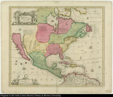
North America Divided into its Principall Parts where are distinguished the severall States which belong to the English, Spanish, and French.
Creator
[Nicolas Sanson d'Abbeville, William Berry]
Map title
Carta geographica de un pais ... in la America septentrional
Creator
Antonio Marquina
Map title
Plan of the Principal Field of Action betweeen the Rivers Cottica and Marawina; with a Sketch of the manner of Encamping in the Woods of Surinam.
Creator
T. Conder
Map title
Amerika, est nor ashkharhagrakan znnut'eants' [America, according to recent authorities]
Creator
Elia Endasian
Map title
Mapa de América, sujecto á las observaciónes astronomicas
Creator
Tomas Lopez de Vargas Machuca
Map title
L'Amerique meridionale, et septentrionale.
Creator
[H. van Loon, Nicolas de Fer]
Map title
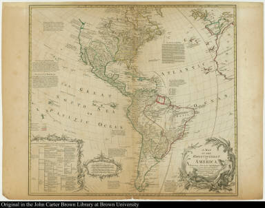
A Map of the Whole Continent of America.
Creator
[Carington Bowles, John Bowles]
Map title
Amérique septentrionale, dressé, sur les Relations les plus modernes des Voyageurs et Navigateurs, et divisée suivant les differentes possessions des Européens.
Creator
Didier Robert de Vaugondy
Map title
L'Amerique suivant le R. P. Charlevoix J[ésui]te Mr de la Condamine
Creator
Georges Louis Le Rouge
Map title
Novus Orbis sive America Meridionalis et Septentrionalis
Creator
Matthäus Seutter
Map title
Totius Americae Septentrionalis et Meridionalis
Creator
Johann Baptist Homann
Map title
Amerique Septentrionale divisée en ses principales parties ...
Creator
[Cordier, Alexis Hubert Jaillot, Nicolas Sanson]
Map title
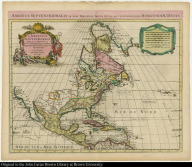
L'Amerique Septentrionale
Creator
Guillaume de l'Isle
Map title
Karte derer Englischen Unternehmungen zur See auf denen Französischen Küsten ... Carte des Entrep:Anglos: par Mer sur les cotes de France ... Anno 1759
Creator
J. A. Frederic
Map title
A New and Correct Map of the British Colonies in North America Comprehending Eastern Canada with ... the Adjacent States of New England ...
Map title
L'Amérique Septentrionale, ou se remarquent les Etats Unis.
Creator
Louis Brion de la Tour
Map title
Carte du theatre de la guerre presente en Amerique
Creator
Louis Denis
Map title
Partie orientale du Canada, avec la Nouvelle Angleterre, l'Acadie, et la Terre-Neuve
Creator
Jean Baptiste Bourguignon d'Anville
Map title
Recens edita totius Novi Belgii in America Septentrionali siti
Creator
Matthäus Seutter
Map title
L'Isle St. Domingue ou Espagnole Decouverte l'an 1492. Par les Espagnols
Creator
Nicolas de Fer
Map title
Jamaica, Americae Septentrionalis Ampla insula. Christophoro Columbo detecta
Creator
[L. v. Anse, Nicolaes Visscher]
Map title
Civitas Carthagena in Indiae occidentalis continente sita, portu commodissimo ad mercaturam inter Hispaniam et Peru exercendam
Map title
Accurata delineatio Ludovicianae vel Gallice Louisiane et Canadae et Floridae adpellatione in Septemtrioali America ...
Creator
[Melchoir Rhein, Gottfried Rogg, Matthäus Seutter]
Map title
Le Canada faict par le Sr. de Champlain où sont La Nouvelle France, La Nouvelle Angleterre, La Nouvelle Holande, La Nouvelle Svede, La Virginie &c.
Creator
Pierre Duval
Map title
Amplissimae Regionis Mississipi seu Provinciae Ludovicianae â R.P. Ludoviso Hennepin Francise Miss in America Septentrionali Anno 1687 detectae
Creator
Johann Baptist Homann
Map title
L'Amerique Septentrionale ou la Partie Septentrionale des Indes Occidentales
Creator
Jean Baptiste François Nolin
|






![Amerika, est nor ashkharhagrakan znnut'eants' [America, according to recent authorities]](https://jcb.lunaimaging.com/media/Size2/JCBMAPS-1-NA/map_migration/00712003.jpg)



![L'Amerique suivant le R. P. Charlevoix J[ésui]te Mr de la Condamine](https://jcb.lunaimaging.com/media/Size2/JCBMAPS-1-NA/map_migration/00712002.jpg)


