REFINE


Who What Where When


REMOVE

  1. 1763

WHAT

  1. Acapulco (Mexico)--Commer … (1)
  2. Adventure and adventurers … (1)
  3. Africa. (2)
  4. Agriculture--French Guian … (1)
  5. Amat y Junient, Manuel de … (1)
  6. Amazons. (1)
  7. Anglo-French War, 1755-17 … (1)
  8. Anglo-Spanish War, 1762-1 … (1)
  9. Anglo-Spanish War, 1762-1 … (1)
  10. Arctic regions. (2)
  11. Artifacts, industry, and … (3)
  12. Asia. (2)
  13. Best books. (7)
  14. Bible Chronology. (1)
  15. Bible Criticism, interpre … (1)
  16. Bibliography. (7)
  17. Bigot, François,--1703-17 … (1)
  18. Booksellers' catalogs--Fr … (7)
  19. Borrote, Pedro,--1731-176 … (1)
  20. Botany, Medical. (1)
  21. Botany--French Guiana. (1)
  22. Botany--Pictorial works. (1)
  23. Botany--South America. (1)
  24. Botany--West Indies. (1)
  25. Broadsides, etc.--Portuga … (2)
  26. Broadsides, etc.--Spain-- … (1)
  27. Canada--History--To 1763 … (2)
  28. Canada--Politics and gove … (1)
  29. Capture at sea. (1)
  30. Carib language--Dictionar … (3)
  31. Castañeda Velázquez y S … (1)
  32. Castro, Inês de,---1355-- … (1)
  33. Catafalques (1)
  34. Catechisms, German. (1)
  35. Christian life--Sermons. (1)
  36. Classification--Books. (7)
  37. Compass. (1)
  38. CPJCB. (1)
  39. CSAIP. (3)
  40. English drama--18th centu … (1)
  41. engraved fold-out map; fo … (1)
  42. Engraved map (5)
  43. Engraved map on 2 sheets, … (2)
  44. Engraved map, color, diss … (1)
  45. Engraved map, colored (8)
  46. Engraved map, colored; 1 … (6)
  47. Engraved map, colored; wi … (3)
  48. Engraved map, dissected a … (1)
  49. Engraved map, dissected a … (2)
  50. Engraved map, mounted on … (1)
  51. engraved map; following p … (1)
  52. engraved map; following p … (1)
  53. engraved map; following p … (1)
  54. engraving (4)
  55. Engraving--Mexico--18th c … (1)
  56. Eskimos--Greenland--Socia … (2)
  57. Eskimos--Greenland. (2)
  58. Etching (1)
  59. Eyeglasses. (1)
  60. fold-out engraved map; fo … (1)
  61. fold-out engraved map; fo … (1)
  62. fold-out engraved map; fo … (1)
  63. fold-out engraved map; fo … (1)
  64. fold-out engraved map; fr … (2)
  65. fold-out engraved map; pl … (1)
  66. France--Colonies--Adminis … (1)
  67. France--Colonies--America … (1)
  68. France--Foreign relations … (1)
  69. Fraud--Canada. (1)
  70. French Guiana--Economic c … (1)
  71. French language--Dictiona … (3)
  72. Funeral rites and ceremon … (1)
  73. Funeral sermons. (1)
  74. Geography--Dictionaries-- … (1)
  75. Germans--Pennsylvania. (4)
  76. Great Britain--Commerce. (1)
  77. Great Britain--Commercial … (1)
  78. Great Britain--Foreign re … (1)
  79. Great Britain--Politics a … (2)
  80. Great Britain--Politics a … (6)
  81. Greenland--Description an … (2)
  82. Greenland--History. (2)
  83. Guadalupe, Our Lady of (1)
  84. Gums and resins. (1)
  85. Guyana--Description and t … (1)
  86. Hebrew language--Grammar. (1)
  87. Hebrew poetry--History an … (1)
  88. Hymns, German. (1)
  89. Imprint 1762. (1)
  90. Imprint 1763. (71)
  91. Imprint 1766. (2)
  92. Imprint 1768. (7)
  93. Imprint 1807. (1)
  94. Indian linguistics--Carib … (3)
  95. Indian linguistics--Eskim … (2)
  96. Indian linguistics--Kalâ … (2)
  97. Indians of South America- … (1)
  98. Indigenous peoples (1)
  99. Jesuits--Controversial li … (1)
  100. Jesuits--Haiti. (1)
  101. Jesuits--Mexico--Biograph … (1)
  102. Jesuits--Mexico--History- … (1)
  103. Jesuits--Missions--Histor … (1)
  104. José,--Prince of Brazil,- … (1)
  105. Judgment Day. (1)
  106. Kalâtdlisut dialect--Glos … (2)
  107. Kalâtdlisut dialect--Gram … (2)
  108. Kerlérec, Louis Billouart … (1)
  109. Lenses--Design and constr … (1)
  110. Lenses. (1)
  111. Louisiana--History--To 18 … (1)
  112. Louisiana--Politics and g … (1)
  113. Lutheran Church--Catechis … (2)
  114. Lutheran Church--Creeds. (2)
  115. Manila (Philippines)--Com … (1)
  116. María Amalia,--consrt of … (1)
  117. Mary, Blessed Virgin, Sai … (1)
  118. María Amalia, consort of … (1)
  119. Materia medica, Vegetable … (1)
  120. Medicine--Formulae, recei … (1)
  121. Metallurgy. (1)
  122. Metals. (1)
  123. Mineral industries. (1)
  124. Natural history--Greenlan … (2)
  125. Nautical astronomy. (1)
  126. Naval art and science. (1)
  127. Navigation--Tables. (1)
  128. Navigation. (1)
  129. New France--Politics and … (1)
  130. Panama--Description and t … (1)
  131. Pedro--I,--King of Portug … (1)
  132. Pharmacopoeias. (1)
  133. Pitt, William,--Earl of C … (2)
  134. Portugal--Foreign relatio … (1)
  135. Portugal--Foreign relatio … (1)
  136. Portugal--History--Joseph … (2)
  137. Rare books--Bibliography. (7)
  138. Reformed Church in the Un … (1)
  139. Rio de Janeiro (Brazil)-- … (1)
  140. Robinsonades. (1)
  141. Rochemore, Marie-Madelein … (1)
  142. Rochemore, Vincent-Gaspar … (1)
  143. Rose,--of Viterbo, Saint, … (1)
  144. Rose,--of Viterbo, Saint, … (1)
  145. Roza, Duarte Lopes,---176 … (1)
  146. Schwenkfelder Church--Cat … (1)
  147. Scientific expeditions. (1)
  148. Sermons--Guatemala. (1)
  149. Sermons--Peru--Lima. (1)
  150. Seven Years' War Bute Adm … (1)
  151. Shipbuilding. (1)
  152. Silkworms--Portugal. (1)
  153. Smallpox. (1)
  154. Sobral, Anselmo José da C … (1)
  155. South America--Descriptio … (1)
  156. South America--History--T … (1)
  157. Spain--Colonies--Defenses … (1)
  158. Spain--Foreign relations- … (1)
  159. Spain--Foreign relations- … (1)
  160. Spain--History, Military. (1)
  161. Steiner, Johann Conrad,-- … (1)
  162. Tar. (1)
  163. Taxation--Portugal. (1)
  164. Tobacco industry--Governm … (1)
  165. Tobacco. (1)
  166. Trials (Fraud)--France. (1)
  167. Vaudreuil, Pierre de Riga … (1)
  168. Voyages and travels. (28)
  169. Voyages, Imaginary. (1)
  170. War. (1)
Less
REFINE 

Browse All : Images from 1763

1-50 of 169
1 2 3 4  
[Catafalque of Bishop Castañeda]
1763
Spanish America
[Catafalque of Bishop C...
Ortega y Pimentel, Isid...
 
Image title
[Catafalque of Bishop Castañeda]
Source place of publication
Lima
Source date
1763
S[an]ta. M[ar]ia Vn. D. Guadalupe D. Mex.
1763
Spanish America
S[an]ta. M[ar]ia Vn. D....
Horta, Pedro de
 
Image title
S[an]ta. M[ar]ia Vn. D. Guadalupe D. Mex.
Source place of publication
En Madrid
Source date
1763
[Catafalque for Maria Amalia de Saxonia, consort to Carlos III]
1763
Spanish America
[Catafalque for Maria A...
Dighero, Juan Antonio
 
Image title
[Catafalque for Maria Amalia de Saxonia, consort to Carlos III]
Source place of publication
Impresso en Guatemala
Source date
1763
IT'S ALL OF A PEACE, or French Leuisdores [sic] for English Bricks.
1763
IT'S ALL OF A PEACE, or...
Seven Years' War Bute A...
[London]
 
Title
IT'S ALL OF A PEACE, or French Leuisdores [sic] for English Bricks.
Image technique
Etching
Subject
Seven Years' War Bute Administration (May 1762-April 1763)
A Map of the Caribbee islands and Guayana, from the best Authorities
1763
A Map of the Caribbee i...
Caribbean
Campbell, John, 1708-17...
 
Map title
A Map of the Caribbee islands and Guayana, from the best Authorities
Nieuwe Naaukeurige Kaart van de Colonie de Berbice door een Liefhebber opgemaakt.
1763
Nieuwe Naaukeurige Kaar...
South America
 
Map title
Nieuwe Naaukeurige Kaart van de Colonie de Berbice door een Liefhebber opgemaakt.
Carte de l'Entrée de la Riviere de Poumaron Suivant les Plans des Hollandois.
1763
Carte de l'Entrée de la...
South America
Bellin, Jacques Nicolas...
 
Map title
Carte de l'Entrée de la Riviere de Poumaron Suivant les Plans des Hollandois.
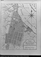
Plan de la ville de Paramaribo Suivant les Plans Hollandois
1763
Plan de la ville de Par...
South America
Bellin, Jacques Nicolas...
 
Map title
Plan de la ville de Paramaribo Suivant les Plans Hollandois
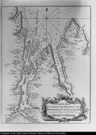
Carte des entrées des Rivieres de Demerary et d'Essequebé Suivant les Plans des Hollandois
1763
Carte des entrées des R...
South America
Bellin, Jacques Nicolas...
 
Map title
Carte des entrées des Rivieres de Demerary et d'Essequebé Suivant les Plans des Hollandois
Carte de l'Isle de Cayenne
1763
Carte de l'Isle de Caye...
South America
Bellin, Jacques Nicolas...
 
Map title
Carte de l'Isle de Cayenne
Cours de l'Orenoque Depuis ses sources jusqu'à la Mer Avec les Rivieres qui s'y déchargent
1763
Cours de l'Orenoque Dep...
South America
Bellin, Jacques Nicolas...
 
Map title
Cours de l'Orenoque Depuis ses sources jusqu'à la Mer Avec les Rivieres qui s'y déchargent
[top] Carte d'une Partie du Cours de l'Orenoque ... [bottom] Carte du Bras principal de la Riviere d'Orenoque ...
1763
[top] Carte d'une Parti...
South America
Bellin, Jacques Nicolas...
 
Map title
[top] Carte d'une Partie du Cours de l'Orenoque ... [bottom] Carte du Bras principal de la Riviere d'Orenoque ...
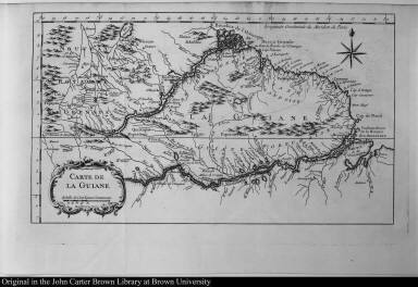
Carte de la Guiane
1763
Carte de la Guiane
South America
Bellin, Jacques Nicolas...
 
Map title
Carte de la Guiane
Piano Scenografico della Città dei Re, ò sia di Lima Capitale del Regno del Perù tal quale era prima che fosse distrutta dall' ultimo Terremoto.
1763
Piano Scenografico dell...
South America
 
Map title
Piano Scenografico della Città dei Re, ò sia di Lima Capitale del Regno del Perù tal quale era prima che fosse distrutta dall' ultimo Terremoto.
Creator
Veremondo Rossi M.V.
[Map of the Atlantic Ocean]
1763
[Map of the Atlantic Oc...
Western hemisphere
Rego, Francisco Xavier ...
 
Map title
[Map of the Atlantic Ocean]
Creator
Anastaçio Joaqm.
A Map of the Colony of Surinam. ...
1763
A Map of the Colony of ...
South America
Clifford, Jeronimy, d. ...
 
Map title
A Map of the Colony of Surinam. ...
Creator
J.H.C. Spiering
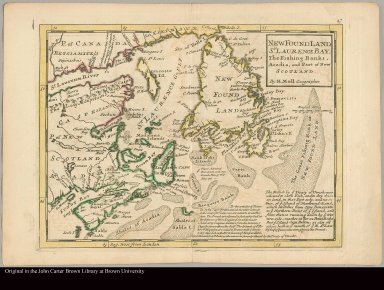
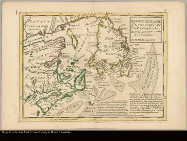
New Found Land, St. Laurence Bay, the fishing banks, Acadia, and part of New Scotland by H. Moll, geographer
1763
New Found Land, St. Lau...
North America
 
Map title
New Found Land, St. Laurence Bay, the fishing banks, Acadia, and part of New Scotland by H. Moll, geographer
Creator
Moll, Herman, d. 1732
A description of the Bay of Fundy shewing ye coast, islands, harbours, creeks, coves, rocks, sholes, soundings & anchorings &c observed by Nat. Blackmore in ye years 1711 and 1712 by Her Majesties special command
1763
A description of the Ba...
North America
 
Map title
A description of the Bay of Fundy shewing ye coast, islands, harbours, creeks, coves, rocks, sholes, soundings & anchorings &c observed by Nat. Blackmore in ye years 1711 and 1712 by Her Majesties special command
Creator
Moll, Herman, d. 1732
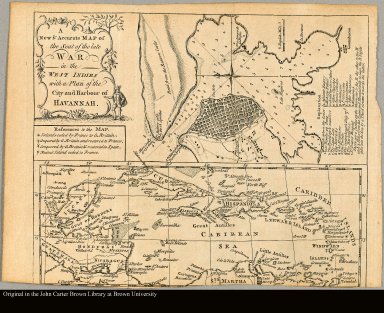
A new & accurate map of the seat of the Late War in the West Indies with a plan of the City and Harbour of Havannah
1763
A new & accurate map of...
Caribbean
 
Map title
A new & accurate map of the seat of the Late War in the West Indies with a plan of the City and Harbour of Havannah
A new and accurate map of the island of Martinico, 1763
1763
A new and accurate map ...
Caribbean
 
Map title
A new and accurate map of the island of Martinico, 1763
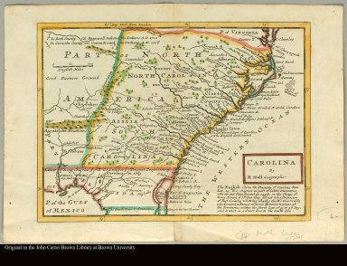
Carolina by H. Moll, geographer
1763
Carolina by H. Moll, ge...
North America
 
Map title
Carolina by H. Moll, geographer
Creator
Moll, Herman, d. 1732
A plan of Port Royal=Harbour in Carolina with the proposed forts, depth of water &c. ... according to an original draught by H. Moll
1763
A plan of Port Royal=Ha...
North America
 
Map title
A plan of Port Royal=Harbour in Carolina with the proposed forts, depth of water &c. ... according to an original draught by H. Moll
Creator
Moll, Herman, d. 1732
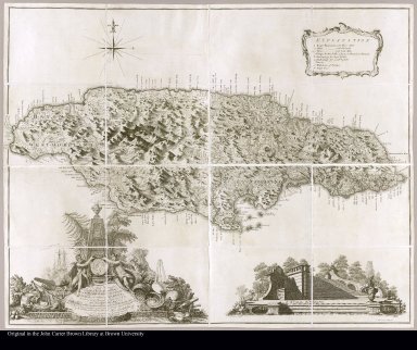
The island of Jamaica divided into its principal parishes with the roads &c. by H. Moll, Geographer
1763
The island of Jamaica d...
Caribbean
 
Map title
The island of Jamaica divided into its principal parishes with the roads &c. by H. Moll, Geographer
Creator
Moll, Herman, d. 1732
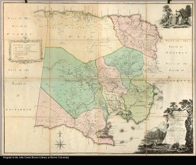
To the Right Honorable George Earl of Halifax, ... This map of the island of Jamaica laid down from the papers and under the direction of Henry Moore, Esqr.; His Majesty's Lieutenant Governor and Commander in Chief of that island, ... Thos. Craskell, engineer, Jas. Simpson, surveyor
1763
To the Right Honorable ...
Caribbean
 
Map title
To the Right Honorable George Earl of Halifax, ... This map of the island of Jamaica laid down from the papers and under the direction of Henry Moore, Esqr.; His Majesty's Lieutenant Governor and Commander in Chief of that island, ... Thos. Craskell, engineer, Jas. Simpson, surveyor
Creator
Craskell, Thomas
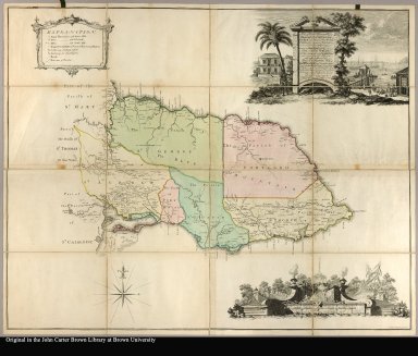
To the Right Honorable Robert Earl of Holdernesse, this map of the County of Cornwall, in the island of Jamaica (laid down from the papers, and under the direction of Henry Moore Esqr. His Majesty's Lieutenant Governor, and Commander in Chief of that Island, in the years 1756, -57, -58, -59, -60, & 61 ; & from a great number of actual surveys performed by the publishers) is humbly inscribed by ... Thos. Craskell engineer, Jas. Simpson surveyor
1763
To the Right Honorable ...
Caribbean
 
Map title
To the Right Honorable Robert Earl of Holdernesse, this map of the County of Cornwall, in the island of Jamaica (laid down from the papers, and under the direction of Henry Moore Esqr. His Majesty's Lieutenant Governor, and Commander in Chief of that Island, in the years 1756, -57, -58, -59, -60, & 61 ; & from a great number of actual surveys performed by the publishers) is humbly inscribed by ... Thos. Craskell engineer, Jas. Simpson surveyor
Creator
[Craskell, Thomas, Fournier, Daniel]
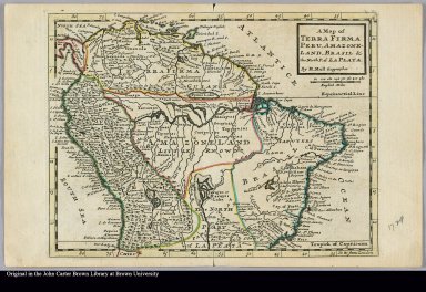
A map of Terra Firma Peru, Amazone-land, Brasil & the north p. of La Plata by H. Moll, geographer
1763
A map of Terra Firma Pe...
South America
 
Map title
A map of Terra Firma Peru, Amazone-land, Brasil & the north p. of La Plata by H. Moll, geographer
Creator
Moll, Herman, d. 1732
A map of Chili, Patagonia, La Plata and ye south part of Brasil by H. Moll, geographer
1763
A map of Chili, Patagon...
South America
 
Map title
A map of Chili, Patagonia, La Plata and ye south part of Brasil by H. Moll, geographer
Creator
Moll, Herman, d. 1732
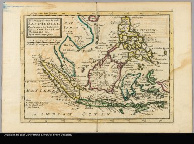
The principal islands of the East-Indies explaining what belongs to England, Spain and Holland &c by H. Moll, geographer
1763
The principal islands o...
Asia
 
Map title
The principal islands of the East-Indies explaining what belongs to England, Spain and Holland &c by H. Moll, geographer
Creator
Moll, Herman, d. 1732
An accurate map of North America describing and distinguishing the British, Spanish and French dominions on this great continent ; according to the definitive treaty concluded at Paris 10th Feby. 1763: Also all the West India islands belonging to and possessed by the several European princes and states the whole laid down according to the latest and most authentick improvements by Eman Bowen geogr: to his majesty and John Gibson engraver
1763
An accurate map of Nort...
North America
 
Map title
An accurate map of North America describing and distinguishing the British, Spanish and French dominions on this great continent ; according to the definitive treaty concluded at Paris 10th Feby. 1763: Also all the West India islands belonging to and possessed by the several European princes and states the whole laid down according to the latest and most authentick improvements by Eman Bowen geogr: to his majesty and John Gibson engraver
Creator
[Bowen, Emanuel, d. 1767, Gibson, John]
To the Right Honorable George Grenville Esqr. First Lord Commissioner of the Treasury ... this map of the County of Surry in the Island of Jamaica (laid down from the papers and under the direction of Henry Moore Esqr. His Majesty's Lieutenant, Governor ... of that Island in the Years 1756, -57, -58, -59, -60 & 61 & from a great number of actual surveys performed by the Publishers) is humbly inscribed by Thos. Craskell Engineer, Jas. Simpson, Surveyor
1763
To the Right Honorable ...
Caribbean
 
Map title
To the Right Honorable George Grenville Esqr. First Lord Commissioner of the Treasury ... this map of the County of Surry in the Island of Jamaica (laid down from the papers and under the direction of Henry Moore Esqr. His Majesty's Lieutenant, Governor ... of that Island in the Years 1756, -57, -58, -59, -60 & 61 & from a great number of actual surveys performed by the Publishers) is humbly inscribed by Thos. Craskell Engineer, Jas. Simpson, Surveyor
Creator
[Craskell, Thomas, Fournier]
To the Right Honorable Wills, Earl of Hillsborough, first Lord Commissioner of Trade & Plantations, this map of the county of Middlesex in the island of Jamaica (laid down from the papers, and under the direction of Henry Moore, Esqr., His Majesty's Lieutenant Governor and Commander in Chief of that island, in the years 1756, -57, -58, -59, -60, & 61 and from a great number of actual surveys performed by the publishers) is humbly inscribed by His Lordship's most obedient & most humble servants, Thos. Craskell, engineer, Jas. Simpson, surveyor
1763
To the Right Honorable ...
Caribbean
 
Map title
To the Right Honorable Wills, Earl of Hillsborough, first Lord Commissioner of Trade & Plantations, this map of the county of Middlesex in the island of Jamaica (laid down from the papers, and under the direction of Henry Moore, Esqr., His Majesty's Lieutenant Governor and Commander in Chief of that island, in the years 1756, -57, -58, -59, -60, & 61 and from a great number of actual surveys performed by the publishers) is humbly inscribed by His Lordship's most obedient & most humble servants, Thos. Craskell, engineer, Jas. Simpson, surveyor
Creator
[Craskell, Thomas, Fournier, Daniel]
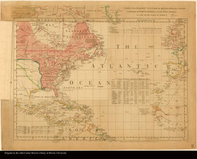
Chart of the Atlantic Ocean, with the British, French, & Spanish settlements in North America, and the West Indies as also on the coast of Africa
1763
Chart of the Atlantic O...
North America
Green, John, d. 1757
 
Map title
Chart of the Atlantic Ocean, with the British, French, & Spanish settlements in North America, and the West Indies as also on the coast of Africa
Creator
Green, John, d. 1757
[Overlay 2] Chart of the Atlantic Ocean, with the British, French, & Spanish settlements in North America, and the West Indies as also on the coast of Africa
1763
[Overlay 2] Chart of th...
North America
Green, John, d. 1757
 
Map title
[Overlay 2] Chart of the Atlantic Ocean, with the British, French, & Spanish settlements in North America, and the West Indies as also on the coast of Africa
Creator
Green, John, d. 1757
Chart of the Atlantic Ocean, with the British, French, & Spanish settlements in North America, and the West Indies as also on the coast of Africa
1763
Chart of the Atlantic O...
North America
Green, John, d. 1757
 
Map title
Chart of the Atlantic Ocean, with the British, French, & Spanish settlements in North America, and the West Indies as also on the coast of Africa
Creator
Green, John, d. 1757
Sheet II. Chart comprizing Greenland with the countries and islands about Baffin's and Hudson's Bays --
1763
Sheet II. Chart compriz...
North America
Green, John, d. 1757
 
Map title
Sheet II. Chart comprizing Greenland with the countries and islands about Baffin's and Hudson's Bays --
Creator
Green, John, d. 1757
Sheet I. Chart containing part of the Icy Sea with the adjacent coast of Asia and America --
1763
Sheet I. Chart containi...
North America
Green, John, d. 1757
 
Map title
Sheet I. Chart containing part of the Icy Sea with the adjacent coast of Asia and America --
Creator
Green, John, d. 1757
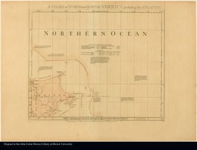
Sheet III. Chart containing the coasts of California, New Albion, and Russian discoveries to the north ... --
1763
Sheet III. Chart contai...
North America
Green, John, d. 1757
 
Map title
Sheet III. Chart containing the coasts of California, New Albion, and Russian discoveries to the north ... --
Creator
Green, John, d. 1757
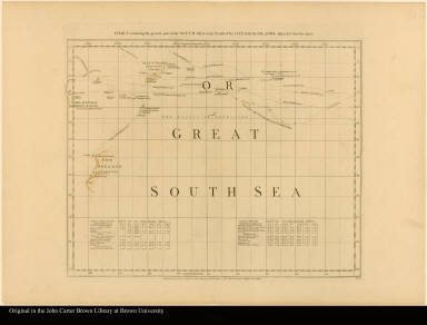
Sheet V. Chart containing the greater part of the South Sea to the south of the line, with islands dispersed thro' the same --
1763
Sheet V. Chart containi...
South America
Green, John, d. 1757
 
Map title
Sheet V. Chart containing the greater part of the South Sea to the south of the line, with islands dispersed thro' the same --
Creator
Green, John, d. 1757
[Sheet] IV. Chart of the Atlantic Ocean, with the British, French, & Spanish settlements in North America, and the West Indies, as also on the coast of Africa --
1763
[Sheet] IV. Chart of th...
western hemisphere
Green, John, d. 1757
 
Map title
[Sheet] IV. Chart of the Atlantic Ocean, with the British, French, & Spanish settlements in North America, and the West Indies, as also on the coast of Africa --
Creator
Green, John, d. 1757
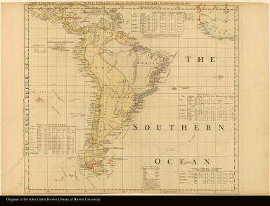
Sheet VI. Chart of South America, comprehending the West Indies, with the adjacent islands, in the Southern Ocean, and South Sea
1763
Sheet VI. Chart of Sout...
South America
Green, John, d. 1757
 
Map title
Sheet VI. Chart of South America, comprehending the West Indies, with the adjacent islands, in the Southern Ocean, and South Sea
Creator
Green, John, d. 1757
[Map of North America]
1763
[Map of North America]
North America
Anville, Jean Baptiste ...
 
Map title
[Map of North America]
Creator
[Anville, Jean Baptiste Bourguignon d', 1697-1782, Delahaye, Guillaume, 1725-1802]
[Map of the southern part of North America]
1763
[Map of the southern pa...
North America
Anville, Jean Baptiste ...
 
Map title
[Map of the southern part of North America]
Creator
[Anville, Jean Baptiste Bourguignon d', 1697-1782, Delahaye, Guillaume, 1725-1802]
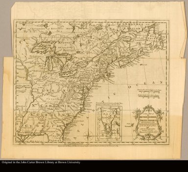
A new map of the British Dominions in North America with the limits of the governments annexed thereto by the late Treaty of Peace, and settled by proclamation, October 7th, 1763
1763
A new map of the Britis...
North America
 
Map title
A new map of the British Dominions in North America with the limits of the governments annexed thereto by the late Treaty of Peace, and settled by proclamation, October 7th, 1763
Creator
Kitchin, Thomas, d. 1784
North America from the French of Mr. d'Anville, improved with the back settlements of Virginia and course of Ohio, illustrated with geographical and historical remarks
1763
North America from the ...
North America
 
Map title
North America from the French of Mr. d'Anville, improved with the back settlements of Virginia and course of Ohio, illustrated with geographical and historical remarks
A new and accurate map of North America laid down according to the latest, and most approved observations and discoveries
1763
A new and accurate map ...
North America
 
Map title
A new and accurate map of North America laid down according to the latest, and most approved observations and discoveries
Creator
Seale, Richard William
Thoughts on trade in general, our West-Indian in particular, our Continental colonies, Canada, Guadaloupe, and the preliminary articles of peace. Addressed to the community.
Thoughts on trade in ge...
Ignotus, active 1763.
printed for John Wilkie
1763
 
Subjects
Imprint 1763.
Considerations on the present peace, as far as it is relative to the colonies, and the African trade.
Considerations on the p...
Roberts, John, governor...
printed for W Bristow
1763
 
Considerations on the present peace, as far as it is relative to the colonies, and the African trade.
Considerations on the p...
Roberts, John, governor...
printed for W Bristow
1763
 
Considerations on the present dangerous crisis.
Considerations on the p...
Ruffhead, Owen, 1723-17...
sn
1763
 
Subjects
Imprint 1763.
Considerations on the present dangerous crisis.
Considerations on the p...
Ruffhead, Owen, 1723-17...
printed for T Becket an...
1763
 
Subjects
Imprint 1763.
1-50 of 169
1 2 3 4