|
REFINE
Browse All : Images by W.B.
1-17 of 17
Map title
Plan of the Fort at Pensacola in West Florida 1764
Creator
W.B.
Map title
[Plan of the town and fort of Louisbourg]
Creator
W.B.
Map title
Plan of the Harbour of Louisbourg
Creator
W.B.
Map title
Plan of Fort Frederick on the River St John's in the Bay of Fundy
Creator
W.B.
Map title
Plan of the Action on the Heights of Abraham near Quebec. Septr. 13th: 1759
Creator
W.B.
Map title
Plan of Quebec and Heights [of] Abraham
Creator
W.B.
Map title
Plan of the Action on the Heights of Abraham 28th. of April 1760
Creator
W.B.
Map title
Pidgeon Island, in the Bay of Fort Royal Martinico
Creator
W.B.
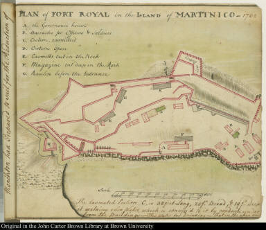
Map title
Plan of Fort Royal in the Island of Martinico -- 1762
Creator
W.B.
Image title
On the Coast of West Florida
Source place of publication
[British North America]
Source date
1764
Image title
Bar of Mobille at the Entrance into the River
Source place of publication
[British North America]
Source date
1764
Image title
A small sea Fish, common about the West India Islands--many of them no larger than the Figure
Source place of publication
[British North America]
Source date
1764
Image title
View of the Mora Castle from the Beach on the West side, beyond the Punta.
Source place of publication
[British North America]
Source date
1764
Image title
View of the Punta Fort, from the beach on the West Side 1762
Source place of publication
[British North America]
Source date
1764
Image title
Part of the Coast of West Fl[orida]
Source place of publication
[British North America]
Source date
1764
Image title
View of Fort Royal in Martinico from the Esplanade 1762
Source place of publication
[British North America]
Source date
1764
1-17 of 17
|

![[Plan of the town and fort of Louisbourg]](https://jcb.lunaimaging.com/media/Size2/JCBMAPS-1-NA/map_migration/02252001.jpg)


![Plan of Quebec and Heights [of] Abraham](https://jcb.lunaimaging.com/media/Size2/JCBMAPS-1-NA/map_migration/02262001.jpg)


![Part of the Coast of West Fl[orida]](http://jcb.lunaimaging.com/media/Size2/D0227/02272001.jpg?userid=2&username=jcbadmin&resolution=2&servertype=JVA&cid=1&iid=JCB&vcid=NA&usergroup=JCB-ADMIN&profileid=1)

