|
REFINE
Media Group: Native America
1-17 of 17
Image title
[Vertrek van den Autheur van Missilimakinak ...]
Source place of publication
Te Leyden [Leiden]
Source date
1704
Image title
[... Arrivée de l'Auteur au Fort S. Joseph à l'embouchure du Lac des Huron. Celle d'un parti des Hurons à ce Fort. Le coup qu'il firent ....]
Source place of publication
A La Haye [The Hague]
Source date
M. DCCIII. [1703]
Image title
Philip. King of Mount Hope
Source place of publication
Newport, Rhode-Island
Source date
1772
Image title
King Philip.
Source place of publication
Boston
Source date
1827
Image title
The Figure of the Indians' Fort or Palizado in New England And the manner of the destroying It by Captayne Vnderhill And Captayne Mason
Source place of publication
London
Source date
1638
Image title
A Man and Woman of the Ottigaumies
Source place of publication
London
Source date
M DCC LXXVIII [1778]
Image title
A Man & Woman of the Naudowessie.
Source place of publication
London
Source date
M DCC LXXVIII [1778]
Image title
Indian of the Nation of the Shawanoes.
Source place of publication
Paris
Source date
1826
Image title
Indian of the Mandanes.
Source place of publication
Paris
Source date
1826
Image title
Indian of the Nation of the Kaskaskia.
Source place of publication
Paris
Source date
1826
Image title
[Qui contient une ample description des voitures de Canada qui sont des Canot d'écorce de bouleau. Comment on les fait, & la manière dont on les navigue.]
Source place of publication
A La Haye [The Hague]
Source date
M. DCCIII. [1703]
Image title
[Native Americans of Canada]
Source place of publication
A La Haye [The Hague]
Source date
M. DCCIII. [1703]
Image title
Et leges et sceptra terit.
Source place of publication
A La Haye [The Hague]
Source date
M. DCCIII. [1703]
Image title
A cheiff Lorde of Roanoac
Source place of publication
Francoforti [Frankfurt]
Source date
Anno MDXC. ... [1590]
Image title
A weroan or great Lorde of Virginia.
Source place of publication
Francoforti [Frankfurt]
Source date
Anno MDXC. ... [1590]
Map title
A new map of Jamaica in which the several towns, forts, and settlements, are accurately laid down as well as ye situations & depts of ye most noted harbours & anchoring places, with the limits & boundarys of the different parishes ... the greatest part drawn or corrected from actual surveys made by Mr. Sheffield and others by Patrk. Browne With corrections & improvements, up to Jany. 1797
Creator
Browne, Patrick, 1720?-1790
Map title
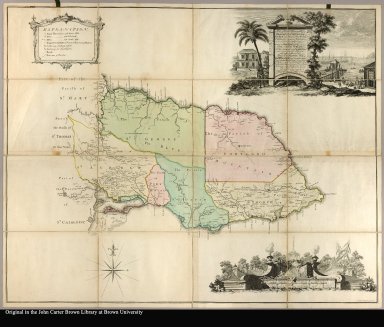
To the Right Honorable George Grenville Esqr. First Lord Commissioner of the Treasury ... this map of the County of Surry in the Island of Jamaica (laid down from the papers and under the direction of Henry Moore Esqr. His Majesty's Lieutenant, Governor ... of that Island in the Years 1756, -57, -58, -59, -60 & 61 & from a great number of actual surveys performed by the Publishers) is humbly inscribed by Thos. Craskell Engineer, Jas. Simpson, Surveyor
Creator
[Craskell, Thomas, Fournier]
1-17 of 17
|
![[Vertrek van den Autheur van Missilimakinak ...]](http://jcb.lunaimaging.com/media/Size2/D0630/06302010.jpg?userid=2&username=jcbadmin&resolution=2&servertype=JVA&cid=1&iid=JCB&vcid=NA&usergroup=JCB-ADMIN&profileid=1)
![[... Arrivée de l'Auteur au Fort S. Joseph à l'embouchure du Lac des Huron. Celle d'un parti des Hurons à ce Fort. Le coup qu'il firent ....]](http://jcb.lunaimaging.com/media/Size2/D0453/04532003.jpg?userid=2&username=jcbadmin&resolution=2&servertype=JVA&cid=1&iid=JCB&vcid=NA&usergroup=JCB-ADMIN&profileid=1)


![[Qui contient une ample description des voitures de Canada qui sont des Canot d'écorce de bouleau. Comment on les fait, & la manière dont on les navigue.]](http://jcb.lunaimaging.com/media/Size1/D0453/04531001.jpg?userid=2&username=jcbadmin&resolution=1&servertype=JVA&cid=1&iid=JCB&vcid=NA&usergroup=JCB-ADMIN&profileid=1)
![[Native Americans of Canada]](http://jcb.lunaimaging.com/media/Size2/D0106/01062009.jpg?userid=2&username=jcbadmin&resolution=2&servertype=JVA&cid=1&iid=JCB&vcid=NA&usergroup=JCB-ADMIN&profileid=1)


