|
Title
THE EUROPEAN STATE JOCKIES Running a Heat for the BALLANCE OF POWER, with various designs adapted for the Year 1740.
Image technique
Engraving
Subject
European balance of power War of Jenkins' Ear
Title
The EVIL GENIUS of ENGLAND Represented in Several SCENES relating to the War
Image technique
Engraving
Subject
War of Jenkins' Ear
Map title
[Northern tip of Newfoundland with 2 vignettes of Quebec and New York cities]
Creator
Toms, William Henry
Map title
[North America showing headwaters of the Mississippi River]
Creator
Toms, William Henry
Map title
[North America showing the Great Lakes]
Creator
Toms, William Henry
Map title
[North America with Nova Scotia to Cape Cod]
Creator
Toms, William Henry
Map title
[George's Banks off of Newfoundland with 3 insets: the harbors at Placentia, Annapolis Royal, and Boston]
Creator
Toms, William Henry
Map title
[North America showing the mouth of the Mississippi River and the Gulf of Mexico]
Creator
Toms, William Henry
Map title
[Southeastern North America showing the coast from Virginia to Florida]
Creator
Toms, William Henry
Map title
[Map of Atlantic Ocean]
Creator
Toms, William Henry
Map title
[Insets of the harbors of New York, Charleston, S.C., Saint Augustine, Florida, and Providence, Bermuda, along with a map of Bermuda]
Creator
Toms, William Henry
Map title
[Mexico and Central America]
Creator
Toms, William Henry
Map title
[Caribbean islands, showing Cuba and upper Antilles]
Creator
Toms, William Henry
Map title
[Caribbean islands, showing lower Antilles]
Creator
Toms, William Henry
Map title
[Insets of the harbor at Havana, and Saint Iago in Cuba, Kingston and Port Antonio in Jamaica, and Fort Royal in Martinique]
Creator
Toms, William Henry
Map title
[Cartouche showing the arrival of Europeans to America]
Creator
Toms, William Henry
Map title
[Map of Central America to the northeastern part of South America]
Creator
Toms, William Henry
Map title
[Map of the northwestern part of South America]
Creator
Toms, William Henry
Map title
[Inset maps of Barbados, Antiqua, the harbors of Cartagena and Porto Bello]
Creator
Toms, William Henry
Map title
[Peru, southern coast, and Chile, northern coast]
Map title
Plan de la baye, et de la ville de Rio-Janeiro, ...
Creator
A. Coquart
Map title
Descripcion de las costas de tierra firme de la America Septentrional ... por el theniente de fragata y piloto de la Real Armada Dn. Antonio de Matos años de 1740.
Creator
Antonio de Matos
Map title
Descripcion de las costas de tierra firme de la America Septentrional ... por el theniente de fragata y piloto de la Real Armada Dn. Antonio de Matos años de 1740.
Creator
Antonio de Matos
Map title
Descripcion de las costas de tierra firme de la America Septentrional ... por el theniente de fragata y piloto de la Real Armada Dn. Antonio de Matos años de 1740.
Creator
Antonio de Matos
Map title
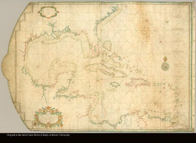
A Map or Chart of the West Indies, drawn from the best Spanish Maps, and regulated by Astronomical Observations.
Map title
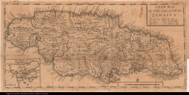
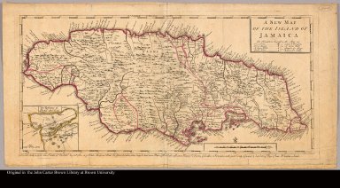
A new map of the island of Jamaica
Map title
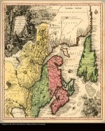
Partie orientale de la Nouvelle France ou du Canada avec l'Isle de Terre-Neuve et de Nouvelle Escosse, Acadie et Nouv. Angleterre avec fleuve de St. Laurence representé par Math. Seutter, Geogr. de S. M. Imper. d'Augsbourg
Creator
Seutter, Matthaeus, 1678-1756
Map title
Recens Edita totius Novi Belgii, in America Septentrionali siti delineatio cura et sumtibus Matthaei Seutteri, Sac. Caes. Maj. Geographi August. Vind. Cum gratia et privil. S.R.I. Vicariat in part. Rheni, Sveciae, et juris Franconici
Creator
Seutter, Matthaeus, 1678-1756
Map title
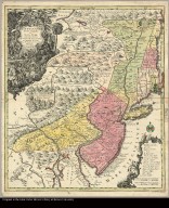
Pensylvania Nova Jersey Et Nova York cum Regionibus Ad Fluvium Delaware In America Sitis, Nova Delineatione ob oculos posita per Matth. Seutterum S.C.M. Geogr. Aug Vind
Creator
[Seutter, Matthaeus, 1678-1756, Lotter, Tobias Conrad, 1717-1777]
Map title
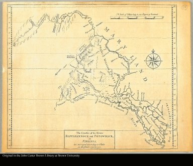
The courses of the Rivers Rappahannock and Potowmack, in Virginia, as surveyed according to order in the years 1736 & 1737
Map title
Le Missisipi ou la Louisiane dans l'Amerique Septentrionale
Map title
Carte d'une partie de l'Amerique pour la navigation des isles et du Golfe du Mexique avec l'interieur des terres depuis la Bermude jusqu'a Cayenne Partie meridionale réduite de la carte angloise en 20 feuilles par Mr. Popple avec quelques corrections et augmentations par Phil. Buache en 1740
Creator
Buache, Phillippe, 1700-1773
Map title
The seat of war in the West Indies, containing new & accurate plans of the Havana, la Vera Cruz, Cartagena and Puert Bello-- also of San Augustin
Map title
A new map of the island of Jamaica
Creator
Foster, George, fl. 1737-1739
Map title
A new and correct plan of the harbour of Carthagena in America seated 16 degrees 26 minutes lat. north and 75 degrees 21 long. west of London, from a draught brought to England by by Pet. Chassereau arch: 1740 Also several remarks concerning ye town of Carthagena & ye forts erected for its defence with a view of ye French ships commanded by De Pointes when he took the town in ye year 1697
Creator
[Chassereau, Pierre, Parr, R.]
Map title
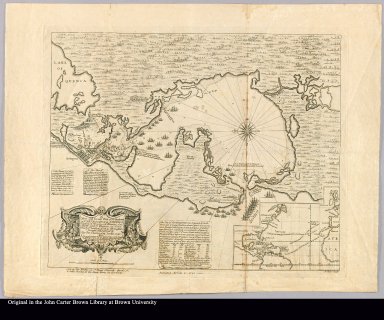
This plan of the harbour, town and forts of Porto Bello (taken by Edward Vernon Esqr. Vice Admiral of the blue on the 22d. of November 1739, with six men of war only) drawn by Lieutent. Philip Durell is most humbly inscribed to the Rt. Honble: Sir Charles Wager, First Lord Commissioner of the Admiralty
Creator
[Durell, Philip, d. 1766, Toms, W. H. (William Henry), ca. 1700-ca. 1750]
Map title
Nieuwe gemeten kaart van de colonie de Berbice : met der zelver plantagien en de namen der bezitters in het ligt gebragt door Reiner & Iosua Ottens kaartverkopers te Amsterdam 1740
Creator
[Ottens, Reiner, 1698-1750, Ottens, Josua, 1704-1765]
Map title
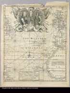
A new map or chart of the Western or Atlantic Ocean, with part of Europe, Africa & America shewing the course of galleons, flota &c. to and from the West Indies
Creator
Bowen, Emanuel, d. 1767
Map title
[Key map]
Creator
[Popple, Henry, d. 1743, Toms, William Henry]
Map title
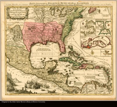
Mappa geographica regionem Mexicanam et Floridam terrasque adjacentes ut et Anteriores Americæ, cursus itidem et reditus navigantium versus flumen Mississipi et alias colonias ob oculos ponens cura et sumptibus Mattæi Seutteri, S. Cæs. et Reg. Cath. Maj. geographi et chalcographi Augustæe Vindel
Creator
[Seutter, Matthaeus, 1678-1756, Lotter, Tobias Conrad, 1717-1777]
Map title
[Canada to Lake Superior with 2 vignettes of Niagara Falls and Mexico City]
Creator
Toms, William Henry
Map title
[Canada from Hudson's Bay to Lake Nipissing]
Creator
Toms, William Henry
Map title
[Eastern Canada showing Saint Lawrence River and Newfoundland]
Creator
Toms, William Henry
Map title
Descripcion de las costas de tierra firme de la America Septentrional--por el theniente de fragata y piloto de la Real Armada Dn. Antonio de Matos año de 1740
Creator
Matos, Antonio de
Image title
A Perspective View of ye Harbour, castles, & town of Porto Bello; with ye Disposition of ye Ships under ye Command of Vice Admiral Vernon ...
Author (contributor)
German Americana Digitization Project (John Carter Brown Library)
Subjects
[Eskimos--Missions., Greenland--Description and travel.]
Author (contributor)
[Portugal and Brazil Digitization Project (John Carter Brown Library), Great Britain. Sovereign (1727-1760 : George II), Spain. Sovereign (1700-1746 : Philip V), Palmella, duque de, 1781-1850, Philip V, King of Spain, 1683-1746., George II, King of Great Britain, 1683-1760.]
Subjects
[Great Britain--Foreign relations--Spain., Spain--Foreign relations--Great Britain., CPJCB., Imprint 1740.]
|


![[Northern tip of Newfoundland with 2 vignettes of Quebec and New York cities]](https://jcb.lunaimaging.com/media/Size1/JCBMAPS-1-NA/1013/34627-005.jpg)
![[North America showing headwaters of the Mississippi River]](https://jcb.lunaimaging.com/media/Size2/JCBMAPS-1-NA/1013/34627-006.jpg)
![[North America showing the Great Lakes]](https://jcb.lunaimaging.com/media/Size2/JCBMAPS-1-NA/1013/34627-007.jpg)
![[North America with Nova Scotia to Cape Cod]](https://jcb.lunaimaging.com/media/Size2/JCBMAPS-1-NA/1013/34627-008.jpg)
![[George's Banks off of Newfoundland with 3 insets: the harbors at Placentia, Annapolis Royal, and Boston]](https://jcb.lunaimaging.com/media/Size1/JCBMAPS-1-NA/1013/34627-009.jpg)
![[North America showing the mouth of the Mississippi River and the Gulf of Mexico]](https://jcb.lunaimaging.com/media/Size2/JCBMAPS-1-NA/1013/34627-010.jpg)
![[Southeastern North America showing the coast from Virginia to Florida]](https://jcb.lunaimaging.com/media/Size2/JCBMAPS-1-NA/1013/34627-011.jpg)
![[Map of Atlantic Ocean]](https://jcb.lunaimaging.com/media/Size2/JCBMAPS-1-NA/1013/34627-012.jpg)
![[Insets of the harbors of New York, Charleston, S.C., Saint Augustine, Florida, and Providence, Bermuda, along with a map of Bermuda]](https://jcb.lunaimaging.com/media/Size1/JCBMAPS-1-NA/1013/34627-013.jpg)
![[Mexico and Central America]](https://jcb.lunaimaging.com/media/Size2/JCBMAPS-1-NA/1013/34627-014.jpg)
![[Caribbean islands, showing Cuba and upper Antilles]](https://jcb.lunaimaging.com/media/Size2/JCBMAPS-1-NA/1013/34627-015.jpg)
![[Caribbean islands, showing lower Antilles]](https://jcb.lunaimaging.com/media/Size2/JCBMAPS-1-NA/1013/34627-016.jpg)
![[Insets of the harbor at Havana, and Saint Iago in Cuba, Kingston and Port Antonio in Jamaica, and Fort Royal in Martinique]](https://jcb.lunaimaging.com/media/Size1/JCBMAPS-1-NA/1013/34627-017.jpg)
![[Cartouche showing the arrival of Europeans to America]](https://jcb.lunaimaging.com/media/Size2/JCBMAPS-1-NA/1013/34627-018.jpg)
![[Map of Central America to the northeastern part of South America]](https://jcb.lunaimaging.com/media/Size2/JCBMAPS-1-NA/1013/34627-019.jpg)
![[Map of the northwestern part of South America]](https://jcb.lunaimaging.com/media/Size2/JCBMAPS-1-NA/1013/34627-020.jpg)
![[Inset maps of Barbados, Antiqua, the harbors of Cartagena and Porto Bello]](https://jcb.lunaimaging.com/media/Size1/JCBMAPS-1-NA/1013/34627-021.jpg)
![[Peru, southern coast, and Chile, northern coast]](https://jcb.lunaimaging.com/media/Size2/JCBMAPS-1-NA/1013/04-56-000.jpg)



![[Coast from St. John's River to Savanna]](https://jcb.lunaimaging.com/media/Size3/JCBMAPS-1-NA/1035/C-6405-000.jpg)




![[Key map]](https://jcb.lunaimaging.com/media/Size1/JCBMAPS-1-NA/1013/34627-001.jpg)
![[Canada to Lake Superior with 2 vignettes of Niagara Falls and Mexico City]](https://jcb.lunaimaging.com/media/Size2/JCBMAPS-1-NA/1013/34627-002.jpg)
![[Canada from Hudson's Bay to Lake Nipissing]](https://jcb.lunaimaging.com/media/Size2/JCBMAPS-1-NA/1013/34627-003.jpg)
![[Eastern Canada showing Saint Lawrence River and Newfoundland]](https://jcb.lunaimaging.com/media/Size2/JCBMAPS-1-NA/1013/34627-004.jpg)
