|
REFINE
Browse All : Images by Faden, William, 1750?-1836
1-7 of 7
Map title
A plan of New York Island, with part of Long Island, Staten Island & east New Jersey, with a particular description of the engagement on the Woody Heights of Long Island, between Flatbush and Brooklyn, on the 27th. of August 1776 between His Majesty's forces commanded by General Howe and the Americans under Major General Putnam, with the subsequent disposition of both armies
Creator
Faden, William, 1750?-1836
Map title
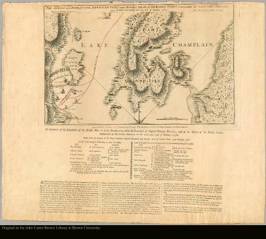
The attack and defeat of the American fleet under Benedict Arnold, by the Kings fleet commanded by Captn. Thos. Pringle, upon Lake Champlain, the 11th of October, 1776
Creator
Faden, William, 1750?-1836
Map title
A plan of New York Island, with part of Long Island, Staten Island & east New Jersey, with a particular description of the engagement on the Woody Heights of Long Island, between Flatbush and Brooklyn, on the 27th. of August 1776 between His Majesty's forces commanded by General Howe and the Americans under Major General Putnam, with the subsequent disposition of both armies
Creator
Faden, William, 1750?-1836
Map title
A map of America, or the New World wherein are introduced all the known parts of the Western Hemisphere, from the map of D'Anville, with the necessary alterations, and the addition of the discoveries made since the year 1761
Creator
[Faden, William, 1750?-1836, Palmer, William]
1-7 of 7
|


