|
Title
BRITONS STRIKE HOME. An Old Song, to a New Tune.
Image technique
Etching
Subject
British political scene
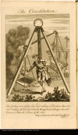
Title
The Constitution.
Image technique
Etching
Subject
British political scene.
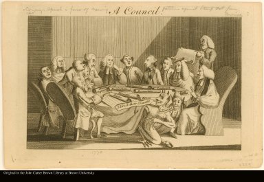
Title
A Council.
Image technique
Engraving
Subject
British political scene.
Title
England's Friends.
Image technique
Etching
Subject
British political scene.
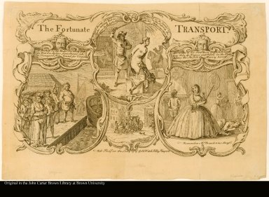
Title
The Fortunate TRANSPORT.
Image technique
Etching
Subject
Social satire
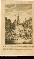
Title
[THE FRUITS OF ARBITRARY POWER, OR THE BLOODY MASSACRE, PERPETUATED IN KING STREET BOSTON ON MARCH 5TH 1770]
Image technique
Etching
Subject
Tension between England and the American colonies.
Title
The Massacre perpetuated in King Street Boston on March 5th. 1770, in which Messrs. Saml. Gray, Saml. Maverick, James Caldwell, Crispus Attucks, Patrick Carr were Killed, six others Wounded, two of them Mortally.
Image technique
Etching
Subject
Tension between Britain and the American colonies.
Title
A Game at Skittles.
Image technique
Etching
Subject
British political scene.
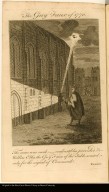
Title
The Guy Faux of 1770.
Image technique
Etching
Subject
British political scene.
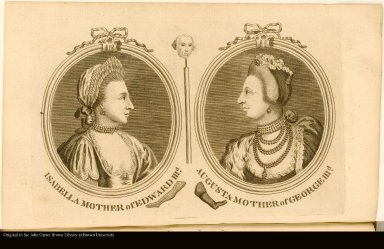
Title
ISABELLA MOTHER of EDWARD IIID. AUGUSTA MOTHER of GEORGE IIID.
Image technique
Etching
Subject
British political scene.
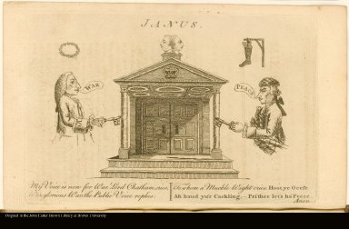
Title
JANUS.
Image technique
Etching
Subject
British political scene
Title
The King and his Friends.
Image technique
Etching
Subject
British political scene.
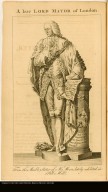
Title
A late LORD MAYOR of London.
Image technique
Etching
Subject
Chatham Administration (August 1766-December 1767)
Title
LORD CHANCELLOR SOMERS. LORD CHANCELOR CAMDEN.
Image technique
Etching
Subject
British political scene
Title
LORD CHIEF JUSTICE JEFFRIES. LORD CHIEF JUSTICE MANSFIELD.
Image technique
Etching
Subject
British political scene
Title
Mr. Garrick delivering his Ode, at Drury Lane Theatre, on dedicating a Building & erecting a Statue, to Shakespeare.
Image technique
Etching
Title
Mr. MACKLIN in the Character of SHYLOCK, in Shakespeare's Merchant of Venice.
Image technique
Etching
Title
The Peace-Makers.
Image technique
Etching
Subject
British political scene.
Title
Political Electricity; or, An Historical & Prophetical Print in the Year 1770.
Image technique
Etching
Subject
British political scene.
Title
The Royal Chace.
Image technique
Etching
Subject
British political scene
Title
Sir Robert Ladbroke aiming at a Peerage.
Image technique
Etching
Subject
British political scene
Title
VOX POPULI VOX DEI.
Image technique
Etching
Subject
British political scene
Author
Cap-Français (Haiti). Conseil supérieur
Title
Arrêt du Conseil supérieur du Cap, concernant les droits salaires & vacations des avocats & procureurs
Subject
[Lawyers, Vacations]
Publisher
Au Cap [Cap-Français, i.e. Cap-Haïtien, Haiti] : chez Guillot, imprimeur bréveté du Roi.
Author
[Saint-Domingue. Assemblée générale, France. Sovereign (1715-1774 : Louis XV), Cap-Français (Haiti). Conseil supérieur, Port-au-Prince (Haiti). Conseil supérieur, Saint-Domingue. Assemblée des deux Conseils supérieurs]
Title
Procés-Verbal [sic] de l'Assemblée des deux Conseils supérieurs de la colonie, des officiers militaires & d'administration y ayant séance, & des commandans des milices des différens quartiers, tenue au Port-au-Prince les 20 & 31 octobre 1770
Publisher
Au Cap [i.e. Cap-Haïtien, Haiti] : chez Guillot, imprimeur bréveté du Roi.
Author
Poupée-Desportes, Jean-Baptiste René, 1704-1748
Title
Histoire des Maladies de S. Domingue,
Subject
Black people,Botany,Pharmacology,Tropical medicine
Publisher
A Paris : Chez Lejay, Libraire, rue S. Jacques, au-dessus de celle des Mathurins, au Grand Corneille
Author
Poupée-Desportes, Jean-Baptiste René, 1704-1748
Title
Histoire des Maladies de S. Domingue,
Subject
Black people,Botany,Pharmacology,Tropical medicine
Publisher
A Paris : Chez Lejay, Libraire, rue S. Jacques, au-dessus de celle des Mathurins, au Grand Corneille
Map title
British Empire in North America with the West India Isles
Creator
Thomas Kitchin
Map title
Nieuwe kaart van de colonie van Suriname, met alle derzelver rivieren, kreeken enz.
Creator
V. van der Plaats junior
Map title
Carte de St. Domingue ou sont marqués les Paroisses Jurisdictions
Map title
Caart van Berbice en Canje.
Creator
Jacob van der Schley
Map title
Plan van het Hoostquartier of Nieuw Retranchement. by de Geweezene Stad Nieuw Amsterdam in Rio Berbice.
Creator
Jacob van der Schley
Map title
Caart van Suriname.
Creator
Jacob van der Schley
Map title
Caart van de Rivieren Corentyn, Copename en Sarameca.
Creator
Jacob van der Schley
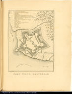
Map title
Fort Nieuw Amsterdam.
Creator
Jacob van der Schley
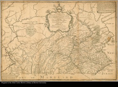
Map title
To the Honorable Thomas Penn and Richard Penn, Esquires, true and absolute proprietaries and Governors of the Province of Pennsylvania and the territories thereunto belonging and to the Honorable John Penn, Esquire, Lieutenant-Governor of the same, this map. Of the Province of Pennsylvania Is humbly dedicated, by their most obedient humble servt.: W. Scull
Creator
Scull, William, fl. 1765
Map title
West Indies from the best authorities By Thos. Kitchin, geor
Creator
Kitchin, Thomas, d. 1784
Map title
[top half of map of Virginia]
Creator
Henry, John, 1704 or 5-1773
Map title
[bottom half of map of Virginia]
Creator
LTO
Map title
Fuerte de San Pedro y su rada en la Ysla de la Martinica.
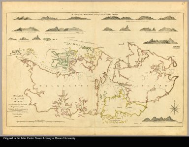
Map title
A draught of Falklands Islands in the latitude of 51° 22' South, longitude 64° 30' West
Creator
Bride, John, ca. 1730-1800
Map title
Mapa y planta del Rio de la Plata leventada y emendata novamente por los Pilotos del Rey Delineada y publicata por le Señor Bellin ... = Carte hydrographique de la Riviere de La Plata Rivier / d'argent dressé sur les cartes et memoires des officiers et Pilotes Espagnoles ... par le Sr. Bellin ...
Creator
Bellin, Jacques Nicolas, 1703-1772
Map title
Topografica da Bahia de todos os Santos, que está em altura de 13 graos de latitude au Sol, e 345 graos e 36 minutos de longitude na qual se vem todos os portos, rios, canais, Ilhas e baixos que estam dentro de las, com todas as Igrejas, e fabricas de Engenho que estam situados a borda de agoa. O Diario, ou relasam geografica que se une a esta planta dam a conhecer muito b? todo o terreno adjacente en a marinha da dita Bahya e se notam todas as distancias, divizoens das Capitanias Mores, e distritos das vilas que se compriendem nela. Foi tirada esta planta por odem do Ilustisimo e Excelentisimo Senhor Conde de Pavolide Governador e Capitam General desta Capitania da Bahia pelo Sargento mor Enginheiro Lente da Aula Militar Jozê Antonio Caldas, reducida e copiada por Jozê Francisco de Souza, Academico compartido na dita Aula
Creator
Caldas, José Antonio, fl. 1750 1770
Map title
[upper left] map of Virginia
Creator
[Jefferys, Thomas, d. 1771, Henry, John, 1704 or 5-1773]
Map title
[lower left] map of Virginia
Creator
[Jefferys, Thomas, d. 1771, Henry, John, 1704 or 5-1773]
Map title
[lower right] map of Virginia
Creator
[Jefferys, Thomas, d. 1771, Henry, John, 1704 or 5-1773]
Map title
A new and accurate map of the World, drawn from the latest observations
Creator
[Bowles, Carington, 1724-1793, J. Elis]
Map title
[upper right] map of Virginia
Creator
[Jefferys, Thomas, d. 1771, Henry, John, 1704 or 5-1773]
|


![[THE FRUITS OF ARBITRARY POWER, OR THE BLOODY MASSACRE, PERPETUATED IN KING STREET BOSTON ON MARCH 5TH 1770]](https://jcb.lunaimaging.com/media/Size1/JCBMAPS-2-NA/1012/36662-1.jpg)


![Procés-Verbal [sic] de l'Assemblée des deux Conseils supérieurs de la colonie, des officiers militaires & d'administration y ayant séance, & des commandans des milices des différens quartiers, tenue au Port-au-Prince les 20 & 31 octobre 1770](http://jcb.lunaimaging.com/MediaManager/srvr?mediafile=/Size1/JCBBOOKS-1-NA/1005/procsverbalsic00sain_7.jpg)


![[top half of map of Virginia]](https://jcb.lunaimaging.com/media/Size3/JCBMAPS-1-NA/1036/28960-001.jpg)
![[bottom half of map of Virginia]](https://jcb.lunaimaging.com/media/Size3/JCBMAPS-1-NA/1036/28960-002.jpg)


![[upper left] map of Virginia](https://jcb.lunaimaging.com/media/Size2/JCBMAPS-1-NA/1075/15513R-001.jpg)
![[lower left] map of Virginia](https://jcb.lunaimaging.com/media/Size2/JCBMAPS-1-NA/1075/15513R-003.jpg)
![[lower right] map of Virginia](https://jcb.lunaimaging.com/media/Size2/JCBMAPS-1-NA/1075/15513R-004.jpg)

![[upper right] map of Virginia](https://jcb.lunaimaging.com/media/Size2/JCBMAPS-1-NA/1075/15513R-002.jpg)
