COLLECTION NAME:
JCB Map Collection
Record
Accession Number:
9009-1
File Name:
9009-1-000
Call number:
Cabinet Ej77 KiT (2)
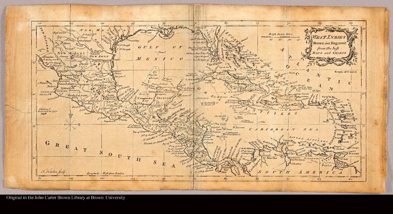
Map title:
West Indies drawn and engraved rom the best maps and charts
Place of Publication:
London
Publication date:
[1779]
Map size height:
18 cm.
Map size width:
37 cm.
Item description:
Engraved map
Geographical description:
Map of the Caribbean islands. Also includes part of Florida, Central America, as well as the northernmost part of South America. "T. Kitchin Sculp."
Cartobibliographic notes:
From: Harvey, Frederick, The naval history of Great Britain; ..., London, J. Bew, 1779.
Geographic Area:
Caribbean
Normalized date:
1779
LC bibliographic number:
b53977051
Creator:
Kitchin, Thomas, d. 1784
West Indies drawn and engraved rom the best maps and charts