COLLECTION NAME:
JCB Map Collection
Record
Accession Number:
31804
File Name:
31804-000
Call number:
Shelf Ck796 BrA 796 (3)
Map title:
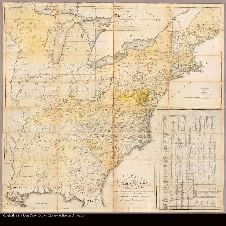
Map of the United States exhibiting the post-roads, the situations, connections & distances of the post-offices, stage roads, counties, ports of entry and delivery for foreign vessels, and the principal rivers by Abraham Bradley junr
Place of Publication:
Philadelphia
Publication date:
1796
Map size height:
89 cm.
Map size width:
94 cm.
Item description:
Engraved map on 4 sheets, colored, mounted on linen
Geographical description:
Map of the United States showing the post roads. At extreme bottom right, "W. Barker sculp. Philad;" below the main title (apparently applying to it alone) "W. Harrison Junr. sc." The upper right sheet (New England and Middle Atlantic states) exhibits a title "A map of the United States exhibiting post roads & distances by Abraham Bradley junr. The first sheet comprehending the nine northern states, with parts of Virginia and the territory north of Ohio." Scale expressed in "Scale of miles" at upper right. "Longitude computed from Washington." Inset, lower right, a self-contained sheet: Progress of the mail on the main line (a graph tabulated in columns, showing the "Progress southward" and "Progress northward" of the mail, summer and winter, between Brewers, Maine, and Charleston, S.C.). In marbled publisher's case labeled: Bradley's map of the United States, exhibiting post-roads and distances.
Cartobibliographic notes:
State 3 with surveyed townships shown in New York and Ohio; in an earlier state (Wheat and Brun II, no. 128) this sheet had an imprint dated April 25, 1796, and bore the name "J. Smither Sculp.," both absent here; this sheet alone was first issued (Wheat and Brun I, no. 127) without any date or engraver's name.
References:
Wheat and Brun 129; JCBAR 56:59-61; Phillips, Maps p. 871; WLCL 1/115; BMPM 3/229; McCorkle 796.4
Geographic Area:
North America
Scale 1:
2,400,000
Normalized date:
1796
LC bibliographic number:
b53976356
Creator:
Bradley, Abraham, 1731-1824
Map of the United States exhibiting the post-roads, the situations, connections & distance...
