COLLECTION NAME:
JCB Map Collection
Record
Accession Number:
C-8241
File Name:
C-8241-000
Call number:
File Cc759 /3
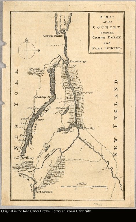
Map title:
A map of the country between Crown Point and Fort Edward
Place of Publication:
London
Publisher:
Gentleman's Magazine
Publication date:
May 1759
Map size height:
19 cm.
Map size width:
12 cm.
Item description:
Engraved map
Geographical description:
Map of New York state, also covers nearby Vermont, chiefly in Rutland County.
Cartobibliographic notes:
From: The gentleman's magazine, v. 29, May 1759.
Geographic Area:
North America
Historical notes:
This map illustrates events of the French and Indian Wars. In 1757 the Marquis de Montcalm marched a sizable force from Fort Carillon (renamed Fort Ticonderoga when captured by the British in 1759) and laid siege to English forces at Fort William Henry. The English eventually were forced to surrender because reinforcements did not arrive. The ensuing Fort William Henry massacre was greatly exaggerated in the press and British troops were extremely reluctant to surrender to the French thereafter.
Scale 1:
ca. 525,000
Normalized date:
1759
LC bibliographic number:
b47291369
A map of the country between Crown Point and Fort Edward