COLLECTION NAME:
JCB Map Collection
Record
Accession Number:
10613
File Name:
10613-000
Call number:
Cabinet Cb776 /2
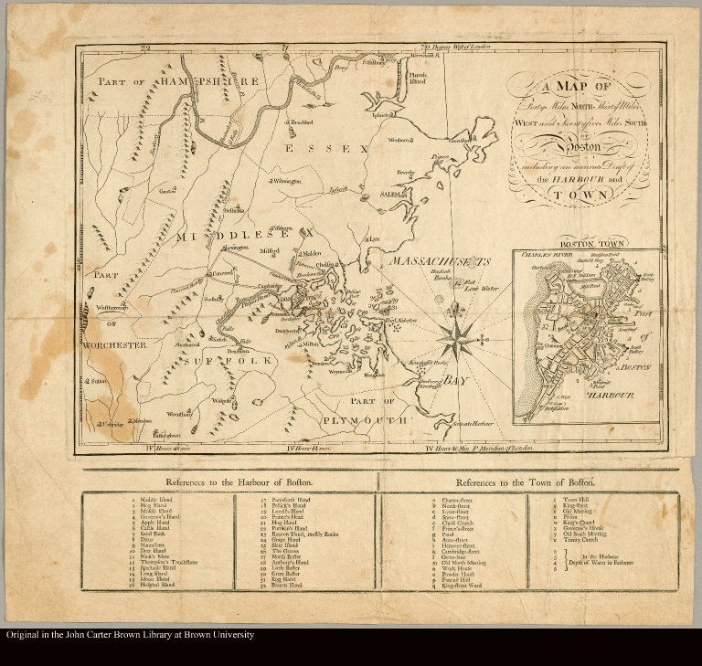
Map title:
A map of forty miles north, thirty miles west, and twentyfive miles south of Boston including an accurate draft of the harbour and town
Place of Publication:
Boston
Publication date:
.1776
Map size height:
29 cm.
Map size width:
43 cm.
Item description:
Engraved map
Geographical description:
Plan of Boston, Massachusetts, and vicinity. Printed in 4 columns below, "References to the Harbour of Boston" numbered 1-32 and "References to the Town of Boston" lettered a-z. Inset at lower right: Boston Town.
References:
Wheat & Brun, no. 205; WLCL 2:13
Geographic Area:
North America
Normalized date:
1776
LC bibliographic number:
53847015
A map of forty miles north, thirty miles west, and twentyfive miles south of Boston includ...