COLLECTION NAME:
JCB Map Collection
Record
Accession Number:
06454
File Name:
06454-11
Call number:
H776 M722c (copy 2)
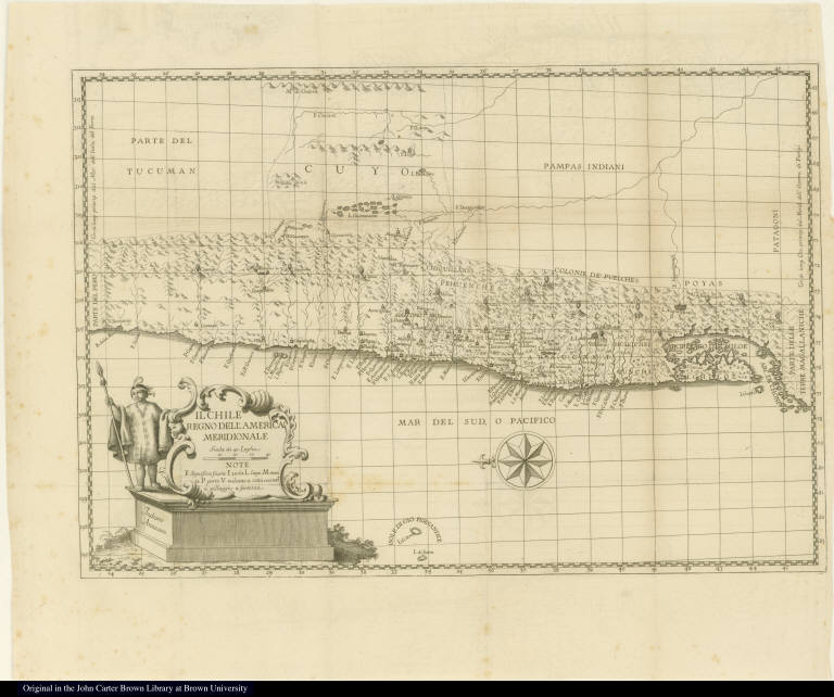
Map title:
Il Chile Regno dell'America Meridionale
Place of Publication:
[Bologna]
Publisher:
[Nella stamperìa di S. Tommaso d'Aquino]
Publication date:
1776
Map size height:
28.5 cm.
Map size width:
41.7 cm.
Item description:
fold-out engraved map; preceding p. 1
Geographical description:
Map of Chile from Peru in the north [on left] to the archipelago of Chiloe in the south. Cartographic elements include lines of latitude and longitude, compass rose, scale, some topographical details, location of settlements, lakes, volcanoes, and native American lands. Decorative cartouche includes an Araucanian Indian with feathered headdress, spear, and poncho.
Source author:
Molina, Giovanni Ignazio, 1740-1829
Source title:
Compendio della storia geografica, naturale, e civile del regno del Chile
Source place:
Bologna MDCCLXXVI. : Nella Stampería di S. Tommaso d' Aquino
Geographic Area:
South America
Historical notes:
This work was published anonymously, but is attributed to Molina.
Normalized date:
1776
Creator:
Giovanni Fabbri
Il Chile Regno dell'America Meridionale