COLLECTION NAME:
JCB Map Collection
Record
Accession Number:
35393
File Name:
35393-1
Call number:
E773 F617v / 1-SIZE
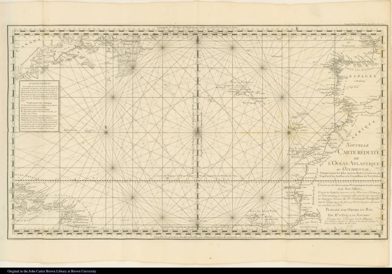
Map title:
Nouvelle Carte Réduite de l'Océan Atlantique ou Occidental ...
Place of Publication:
[Paris]
Publisher:
[Royal Press]
Publication date:
[1773]
Map size height:
38.1 cm.
Map size width:
67.8 cm.
Item description:
fold-out engraved map; following p. 758
Geographical description:
Map of the Atlantic Ocean showing the west coast of Europe and Africa, Nova Scotia and Labrador, as well as some Caribbean islands, the Azore, Canary, Madeira, and Cape Verde islands. Cartographic elements include degrees of latitude and longitude, compass rose, rhumb lines, and sea banks or shoals.
Source author:
Fleurieu, C. P. Claret (Charles Pierre Claret), comte de, 1738-1810
Source title:
Voyage fait par ordre du roi en 1768 et 1769, à différentes parties du monde, pour éprouver en mer les horloges marines inventées par M. Ferdinand Berthoud ... Première partie ...
Source place:
A Paris : de l'Imprimerie royale, M. DCCLXXIII.
Geographic Area:
Western hemisphere
Historical notes:
A statesman and scientist, Fleurieu constructed several nautical instruments which assisted ships in determining their longitude. In 1768, in command of the frigate, Isis, he took exact observations using his new instruments at Martinique, Santo Domingo, Puerto Rico, Cuba, Jamaica, Colombia, New Orleans, New York, Boston, and Newfoundland.Engraver may be Petin.
Normalized date:
1773
Creator:
C. P. Claret (Charles Pierre Claret), comte de Fleurieu
Nouvelle Carte Réduite de l'Océan Atlantique ou Occidental ...