COLLECTION NAME:
JCB Map Collection
Record
Accession Number:
8189
File Name:
8189-3
Call number:
Cabinet Blathwayt 3
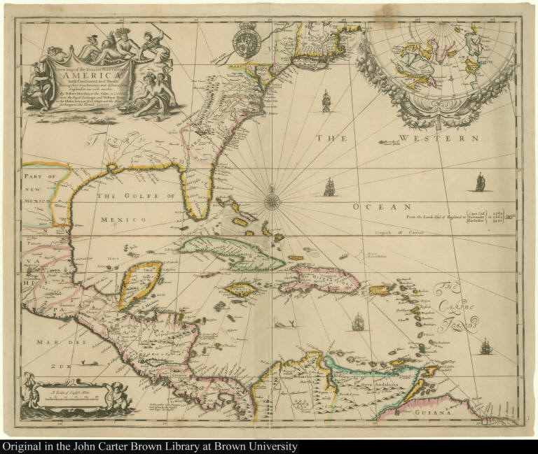
Map title:
A New Map of the English Plantations in America, both Continent and Ilands, Shewing their true Situation and distance, from England or one with another
Place of Publication:
London
Publisher:
By Robert Morden at the Atlas in Cornhill nere the Royal Exchange, and William Berry at the Globe ...
Publication date:
[1673]
Map size height:
43.7 cm.
Map size width:
54 cm.
Item description:
engraving
Geographical description:
Map showing eastern part of North America to the northern part of South America. Includes inset of north polar projection. Cartographic elements include lines of latitude and longitude, scale, sea banks, topographical details, and compass rose. Decorative elements include ships, whale, English royal coat of arms of Charles II, and angels. Decorative cartouche shows native Americans with bighorn sheep and armadillo [?].
Cartobibliographic notes:
This is one of the earliest maps to be published with the intention of representing all of the British interests in America from Hudson's Bay to Guiana.The Blathwayt Atlas is a collection of 48 maps assembled between 1680 and 1685 as a reference atlas for the Office of Trade and Plantations, compiled by William Blathwayt, Secretary to the Lords of Trade and Plantations.
References:
Black, J.D., ed. Blathwayt Atlas, vol. II, p. 43-45
Geographic Area:
North America
Normalized date:
1673
A New Map of the English Plantations in America, both Continent and Ilands, Shewing their ...