COLLECTION NAME:
JCB Map Collection
Record
Accession Number:
03200
File Name:
03200-1
Call number:
E782 R655ni
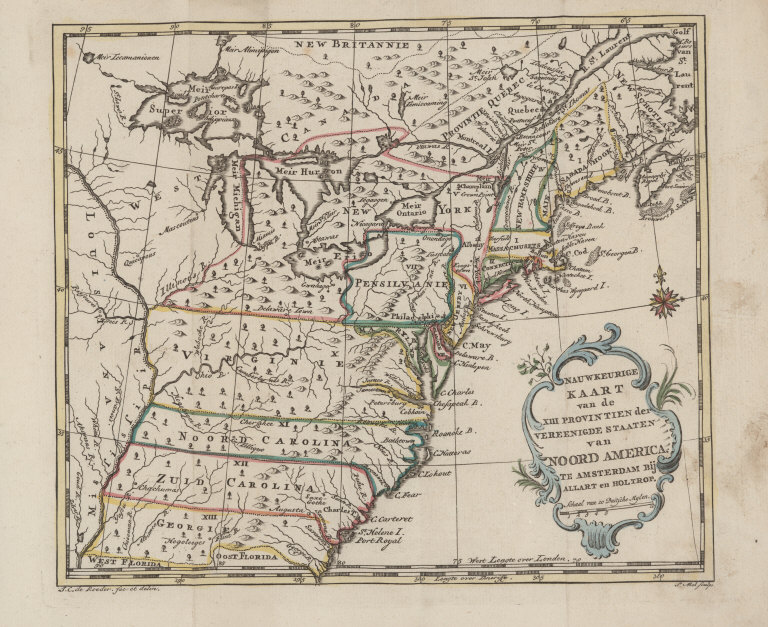
Map title:
Nauwkeurige Kaart van de XIII Provintien de Vereenigde Staaten van Noord America
Place of Publication:
Te Amsterdam
Publisher:
bij Allart en Holtrop
Publication date:
[1782]
Map size height:
18.8 cm.
Map size width:
22.1 cm.
Item description:
fold-out engraved map; following p. viii, hand coloring
Geographical description:
Map of the northeastern part of North America showing the thirteen colonies. Cartographic details include lines of latitude and longitude, names of rivers and bays, and a scale.
Source author:
Robin, abbé, 1750-1794
Source title:
[Nouveau voyage dans l'Amérique septentrionale, en l'année 1781. Dutch] Nieuwe reize door Noord-Amerika, in den jaare 1781.
Source place:
Te Amsterdam, : Bij Allart en Holtrop., MDCCLXXXII.
References:
McCorkle, B.B. New England in Early Printed Maps, 782.12
Geographic Area:
North America
Normalized date:
1782
Creator:
Pieter Mol
Creator:
J. C. de Roeder
Nauwkeurige Kaart van de XIII Provintien de Vereenigde Staaten van Noord America