COLLECTION NAME:
JCB Map Collection
Record
Accession Number:
C-0011
File Name:
C-0011
Call number:
Cabinet Ca679 /1.1
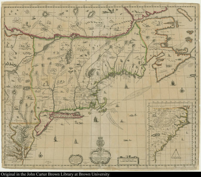
Map title:
A Map of ye English Empire in ye Continent of America Viz. Virginia Maryland Carolina New York New Iarsey New England by R. Daniel Esqr.
Place of Publication:
London
Publisher:
Sold by R. Morden at ye Atlas in Cornhill near ye Royal Exchang & by W. Berry at ye Globe near Charing Cross
Publication date:
[ca. 1679]
Map size height:
50 cm.
Map size width:
59.7 cm.
Item description:
engraving, hand coloring
Geographical description:
Map of the northeast coast of North America from Labrador to the Chesapeake Bay. Inset map includes coast from Chesapeake Bay to Saint Augustine. Cartographic elements include lines of latitude and longitude, sea banks, and scales.
References:
McCorkle, B.B. New England in Early Printed Maps, 679.1
Geographic Area:
North America
Normalized date:
1679
Creator:
Roger l'Estrange
Creator:
W. Binneman
Creator:
Richard Daniel
A Map of ye English Empire in ye Continent of America Viz. Virginia Maryland Carolina New ...