COLLECTION NAME:
JCB Map Collection
Record
Accession Number:
69-1068
File Name:
69-1068-15
Call number:
D828 F331t / 1-SIZE
Map title:
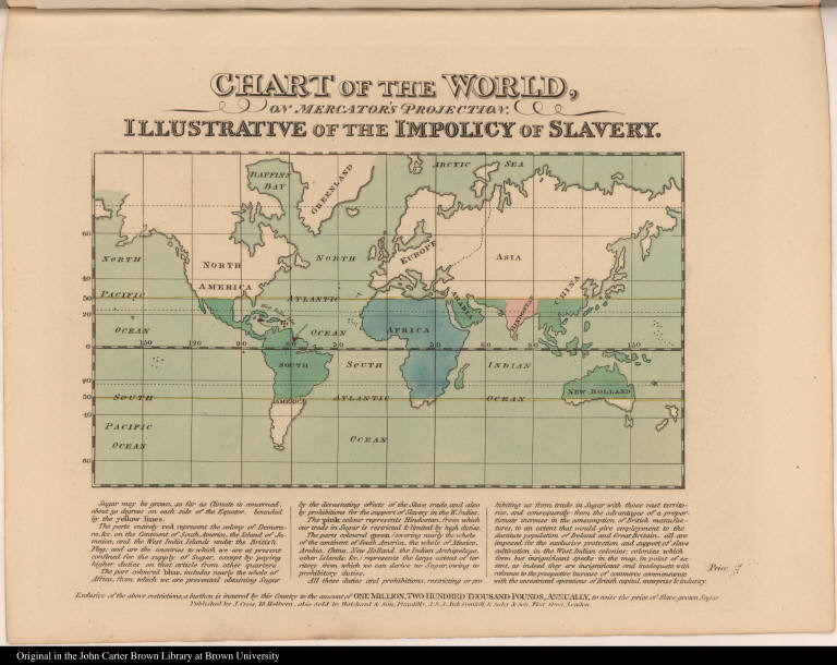
Chart of the World, on Mercator's Projection. IIlustrative of the Impolicy of Slavery.
Place of Publication:
London
Publisher:
J. Cross, ... also sold by Hatchard & son, ... J. & A. Arch, ... & Seeley & Son ...
Publication date:
[1828]
Map size height:
17.8 cm. (platemark)
Map size width:
22 cm. (platemark)
Item description:
engraved map; [part 25], hand coloring
Geographical description:
Map of the world showing the areas in which sugar can be grown. Cartographic elements include lines of latitude and longitude. The part of the world in which sugar cane can be grown is differently colored according to the kinds of restrictions exerted over different areas by different countries.
Source author:
Female Society, for Birmingham, West-Bromwich, Wednesbury, Walsall, and Their Respective Neighbourhoods, for the Relief of British Negro Slaves
Source title:
[Album for the relief of British negro slaves]
Source place:
Birmingham: 1828]
Geographic Area:
World
Historical notes:
The Birmingham Female Society for ... the relief of British negro slaves was founded in 1825, and was established as an emancipationist or abolitionist group and to raise charity funds to relieve the suffering of British negroes. This album was produced by the women to encourage public support for the abolitionist cause and contains a diverse collection of abolitionist poems, newspapers, engravings, and illustrations against slavery in the British West Indies. Image placed horizontally on page.
Normalized date:
1828
Chart of the World, on Mercator's Projection. IIlustrative of the Impolicy of Slavery.