COLLECTION NAME:
JCB Map Collection
Record
Accession Number:
C-8205
File Name:
C-8205
Call number:
Cabinet Em770 / 1 Ms.
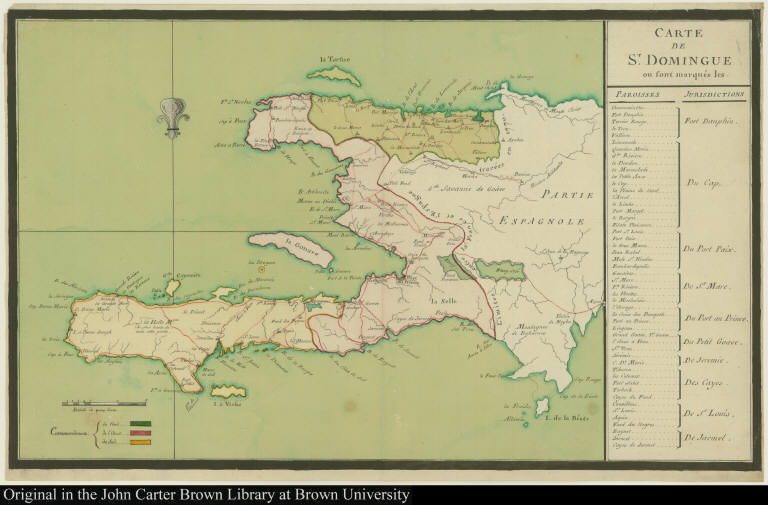
Map title:
Carte de St. Domingue ou sont marqués les Paroisses Jurisdictions
Publication date:
[1770]
Map size height:
32.5 cm.
Map size width:
53.2 cm.
Item description:
manuscript, hand coloring
Geographical description:
Map of Saint Domingue, present-day Haiti, showing parishes and jursidictions. Cartographic elements include the line between the French and Spanish on the island of Hispaniola, scale, and location of rivers, lakes, and bays.
Cartobibliographic notes:
This map states that the frontier was traced in 1770, even though the process of surveying didn't begin until August 1771. In fact, this map was probably drawn after 1777, since the marking of the frontier only began in February 1776; the definitive treaty fixing the boundary limits was not finalized until August 1776 and was ratified in June 1777. (Information provided by David Geggus.)
Geographic Area:
Caribbean
Normalized date:
1770
Carte de St. Domingue ou sont marqués les Paroisses Jurisdictions