COLLECTION NAME:
JCB Map Collection
Record
Accession Number:
14546
File Name:
14546
Call number:
Cabinet Ca682 /1.1
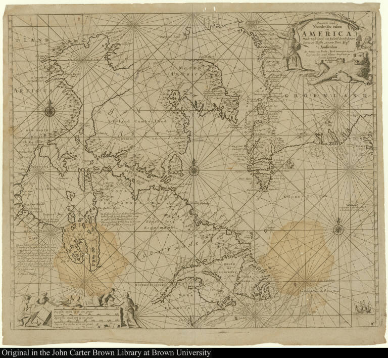
Map title:
Pascaarte vande Noorder Zee custen van America, Vande West-hoeck van Ysland doorde Straet Davis en Hudson, tot aen Terra Neuf
Place of Publication:
Amsterdam
Publisher:
By Johannes van Keulen Boeck vercooper en graadboogh maecker, aende Nieuwe-brugh inde gekroonde Lootsman
Publication date:
[ca. 1702]
Map size height:
50.6 cm.
Map size width:
59 cm.
Item description:
engraving
Geographical description:
Chart of the mouth of the St. Lawrence River to Hudson Bay, including Greenland, Nova Scotia, Labrador, Davis Strait, and Newfoundland. Cartographic elements include rhumb lines, wind roses, scales, degrees of latitude, sea banks and soundings. Decorative elements include native Americans working and being paid for work by Europeans, ship, and birds. Decorative cartouche shows Inuits hunting with bow and arrow a polar bear with her cubs.
References:
Koeman, I.C. Atlantes Neerlandici, IV, p. 350, no. [10] (Keu 110A); Phillips, P.L. Atlases, 5690, no. [3] & 3660, no. [42]
Geographic Area:
North America
Normalized date:
1702
Pascaarte vande Noorder Zee custen van America, Vande West-hoeck van Ysland doorde Straet ...