COLLECTION NAME:
JCB Map Collection
Record
Accession Number:
31983
File Name:
31983
Call number:
Cabinet G56 Fo
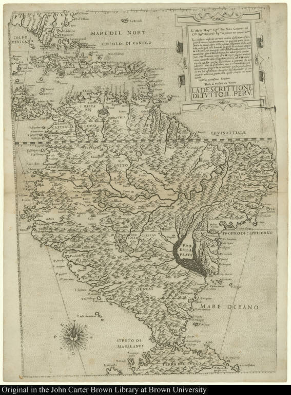
Map title:
La Descrittione di tutto il Peru
Place of Publication:
[Venice]
Publication date:
[ca. 1564-1572]
Map size height:
50.6 cm.
Map size width:
35.6 cm.
Item description:
engraving
Geographical description:
Map of South America, including the Caribbean islands and the tip of Florida. Cartographic elements include lines of latitude, wind rose, and topographical details.
References:
R.V. Tooley, "Maps in Italian Atlases of the Sixteenth Century," III (1939) Imago Mundi, p. 12-47, item #93.
Geographic Area:
South America
Historical notes:
This is the first map to show the interior of South America in great, although often faulty, detail. Forlani was a noted sixteenth-century Italian mapmaker, as well as a publisher of maps.
Normalized date:
1564
Creator:
Paolo di Forlani
La Descrittione di tutto il Peru