COLLECTION NAME:
JCB Map Collection
Record
Accession Number:
67-474
File Name:
67-474-1
Call number:
D635 R382o (copy 2)
Map title:
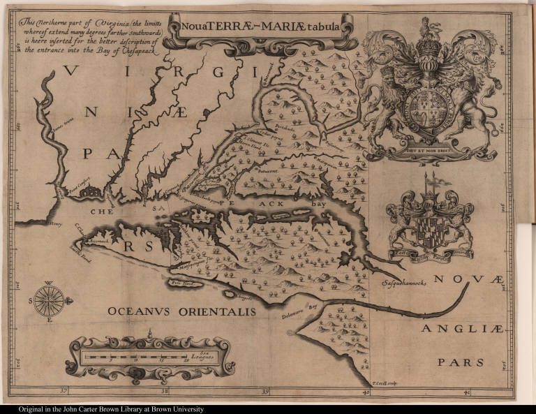
Nova Terrae-Mariae tabula
Place of Publication:
[London]
Publication date:
[1635]
Map size height:
29.9 cm.
Map size width:
39 cm.
Item description:
fold-out engraved map; preceding p. 1
Geographical description:
Map of Maryland showing the Chesapeake and Delaware bays. Cartographic elements include dgrees of latitude and longitude, location of rivers, compass rose, scale, and some topographical details. Decorative elements include the English royal coat of arms (with lions and unicorn) and the Calvert coat of arms
Source title:
A relation of Maryland; : together, vvith a map of the countrey, the conditions of plantation, His Majesties charter to the Lord Baltemore
Source place:
[London] : These books are to bee had, at Master William Peasley, Esq; his house, on the back-side of Drury-Lane, neere the Cock-Pit playhouse; or in his absence, at Master Iohn Morgans house in High Holbourne, over against the Dolphin, London, September the 8 anno Dom. 1635
References:
Baer, E. Maryland, 22
Geographic Area:
North America
Historical notes:
Maryland was first settled in 1634 by colonists under the patent granted to the Calvert family by King Charles I. The Calverts intended to found the colony to restore their fortune and to provide a refuge for English and Irish Roman Catholics. This promotional tract, the fourth to be published, contained the first map solely devoted to Maryland. The map, commonly known as Lord Baltimore's map, was used in the border disputes of later years. It may have been prepared by Jerome Hawley and John Lewger, who were part of the first expedition to Maryland and who compiled the tract.
Normalized date:
1635
Creator:
T. Cecill
Nova Terrae-Mariae tabula
